Quake Stricken in Texas
You might tremor to know how many earthquakes and their magnitude have impacted our state of Texas. The earliest recorded earthquake in Texas was on February 14, 1847, located in Sequin, Texas, with a magnitude of 3.6. Since then, over 200 earthquakes over 3.0 on the Richter Scale have been documented. Shockingly there have been six earthquakes between 5.0 and 6.0, all located with an epicenter in West Texas or the Texas Panhandle. The 5.0 Mentone Texas quake happened on March 26, 2020. People felt tremors as far as away as the City of El Paso.
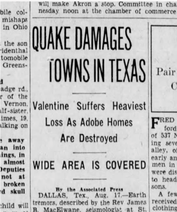
The strongest earthquake reported in Texas was the 6.0 earthquake with an epicenter in Valentine, Texas (Jeff Davis County) on August 16, 1931. Newspapers reported this geological phenome was felt as far east as Taylor, Texas (Williamson County just north of Austin, Texas). An alarming seven tremors shook the area that day, some lasting as long as 72 seconds. The series of quakes started early morning and continued to the early afternoon. The earthquake was felt as far south as San Antonio. Comanche Springs, which is located 100 miles northeast, reported that the water out of the springs, 60 million gallons at the time, was muddy for an hour after the quakes. Damage to buildings and chimneys was reported in Valentine. Sources say that almost all the buildings in the area were damaged. As the buildings continued to sway, the town citizens took refuge outside and slept out in the open that night. This earthquake was even felt in Carlsbad, New Mexico, and affected the Caverns.
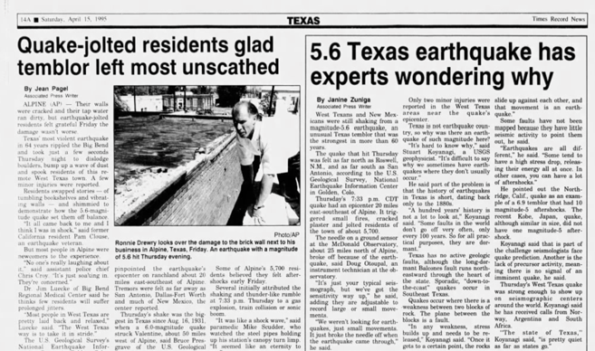
The second most robust earthquake was a 5.7 on April 14, 1995, with an epicenter in Alpine in Brewster County. Some of the impacts are reports of water main damage, fire hydrants, cracked walls, breaking gas mains, creating fires, and causing landslides. The area was stunned with 12 minutes of aftershocks.

To round out the subsequent three strongest earthquakes in Texas include
| Rank in Texas | Year | Day | Month | Time | Magnitude | County | City |
|---|---|---|---|---|---|---|---|
| 1 | 1931 | 16 | Aug | 6 | Jeff Davis | Valentine | |
| 2 | 1995 | 14 | April | 5.7 | Brewster | Alpine | |
| 3 | 1925 | 30 | Jul | 1970-01-01 12:17:00 | 5.4 | Carson | Panhandle |
| 4 | 1948 | 12 | Mar | 1970-01-01 04:29:00 | 5.2 | Dallam | Dalhart |
| 5 | 1936 | 20 | Jun | 1970-01-01 03:24:06 | 5 | Hutchison | Borger |
| 5 | 2020 | 26 | Mar | 1970-01-01 09:16:27 | 5 | Loving | Mentone |
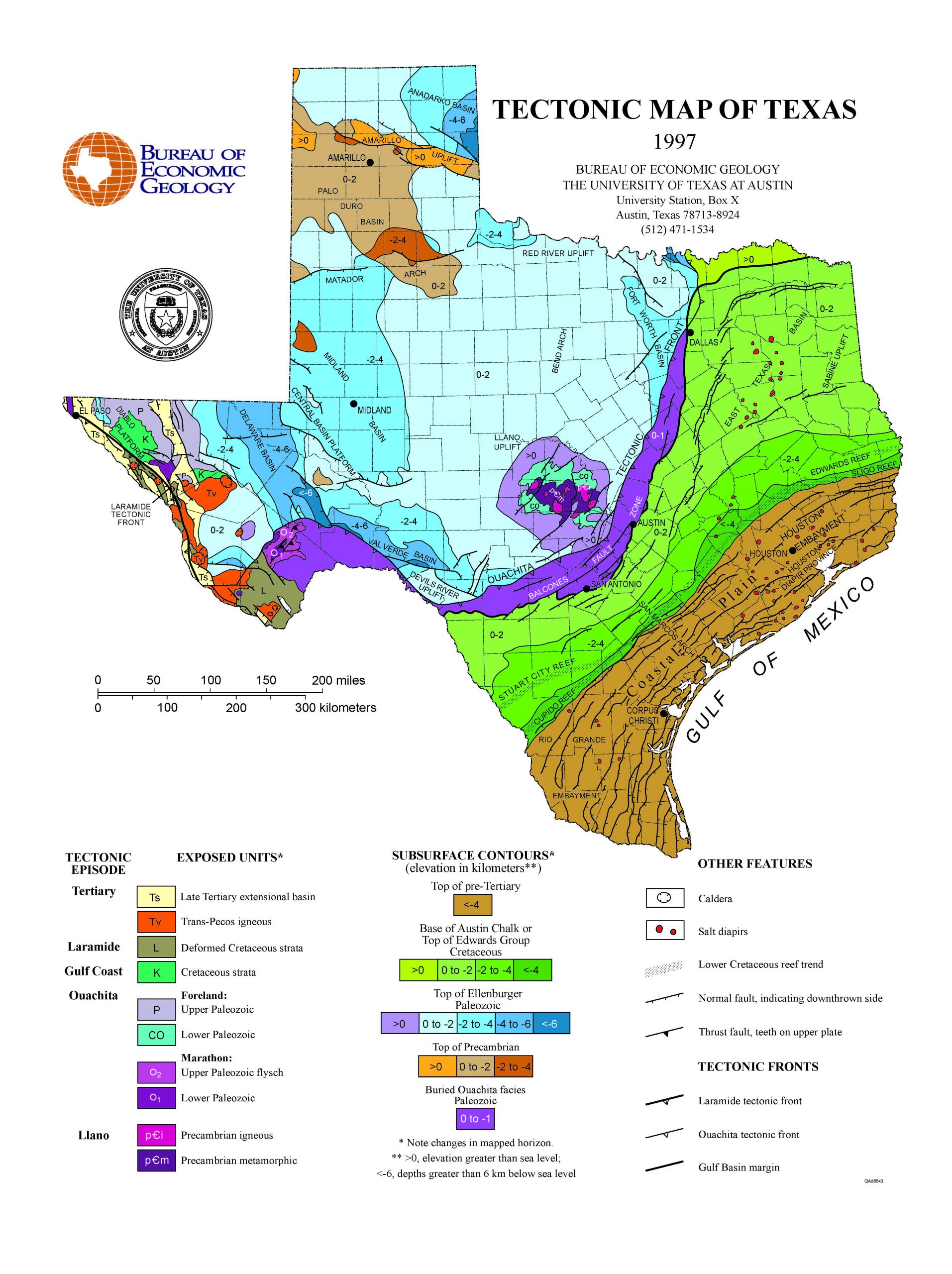
Jeff Davis and Potter counties have experienced 13 reported more significant magnitude earthquakes. Winkler county has experienced 16 reported earthquakes within 3 to 4 magnitude. This is due to the fault lines for the Rio Grande Rift belt, the Panhandle belt, the Ouachita belt located in West Texas, and the Panhandle areas. Another tectonic fault line is near the Coastal Plain.
Large earthquakes have also impacted Texas from Mexico, such as September 19, 1985, which had a magnitude of 8.0. This earthquake centered in Mexico City was felt as far north as Houston. Some Texas cities experienced broken water pipes and other damage.
While there are earthquakes almost every year in Texas detected by seismograms, these earthquakes are small in magnitude. As engineers and readied citizens, it is essential to know your risk in where you are designing and living on earthquakes. An easy way to find out the history of earthquakes in your area is to visit http://www-udc.ig.utexas.edu/external/TXEQ/index.html. This site provides an easy way to look at recorded earthquakes by county. This link is the Texas Earthquakes site by the Institute for Geophysics at the Jackson School of Geosciences at the University of Texas at Austin. The site has resources that you can also study further about being ready to protect your family and other information. Another site to look at would be the USGS Earthquake Hazards for the latest earthquakes. https://www.usgs.gov/natural-hazards/earthquake-hazards/earthquakes


